
“Just add GNSS” is the kind of instruction that sounds tidy until the first outdoor test. The drone holds altitude, but the track slides sideways near a shiny roof. A ground robot behaves for ten minutes, then “teleports” when it turns between buildings. A tracker reports a clean coordinate—confidently—on the wrong bank of a canal. Nobody did anything “wrong.” The world simply refused to look like an open-sky demo.
Choosing a gnss receiver module is therefore less like picking a commodity chip and more like deciding how your device will behave under pressure: what it should do when the sky is partly blocked, what uncertainty looks like in your logs, and how much wrong you can tolerate before the product starts making bad decisions on your behalf.
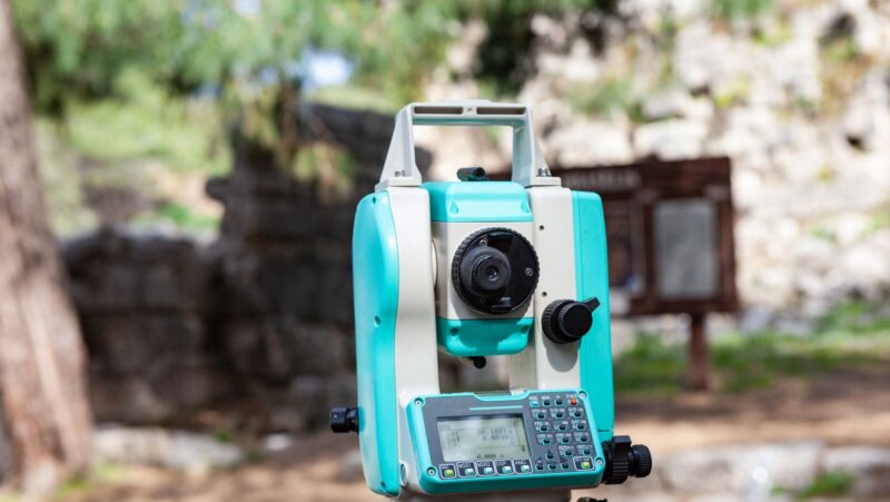
In UAV mapping, this choice is often about timing as much as positioning: logging photo events precisely (and handling RTK/PPK corrections well) is what lets you trust geotags and rely on fewer GCPs.
Embedded GNSS lives next to everything that makes it harder
Survey workflows usually assume a trained operator, deliberate setup, and time to verify. Embedded systems get none of that. Your receiver sits next to motors, switching regulators, radios, batteries, carbon frames, and whatever enclosure design made sense to the product team that week. It’s expected to work while the device is moving, vibrating, heating up, sleeping to save power, and waking again as if nothing happened.
So “good” in embedded positioning isn’t a best-case screenshot. It’s long-run behavior: the device stays consistent, fails gracefully, and produces outputs your software stack can interpret without guessing. If you borrow requirements from land surveying without adapting them, you can pay for the wrong strengths and still miss what the product actually needs.
Decide what “bad GNSS” should look like in your product
The decisive moments are the ugly ones: partial sky view, interference, canopy edges, multipath reflections that look like truth. Before comparing modules, write a policy for what the device should do when conditions deteriorate.
Should it keep publishing positions but flag uncertainty clearly? Should it hold outputs when confidence drops? Is a rough position acceptable, or is a wrong one worse than silence? Will you fuse GNSS with inertial data, wheel odometry, visual navigation, or map constraints—or is GNSS your only truth source?
This isn’t paperwork. It’s how you prevent a classic product failure: emitting confident nonsense because “a coordinate is required.”
“Accuracy” means different things on different platforms
Teams often argue about accuracy as if it were a single number. In embedded systems, it splits into different needs:
For drones (especially mapping), trajectory quality matters: stable timestamps, consistent bias you can model, and a position stream that stays coherent when the platform moves fast. A slightly biased but stable solution can be more useful than a solution that occasionally leaps.
For robots in built environments, recovery and plausibility matter. When the robot turns near buildings, the position stream must remain physically believable—and reacquire quickly after brief interruptions.
For IoT trackers, power and outliers dominate. One wildly wrong point can poison analytics, geofences, and customer trust. “Good enough but stable” often beats “sometimes excellent, sometimes absurd.”
So when you read module specs, translate them into your use case: what kind of “accuracy” are you actually buying?
Start design work where most projects quietly fail
Antenna choices and placement will decide whether the module’s capability ever reaches the real world. It’s common to pick a strong module and then starve it with a compromised antenna environment.
This is what that looks like in practice: your prototype works fine on a bench, then you mount it in the final enclosure near a noisy regulator and a motor driver. Suddenly fixes take longer, quality indicators wobble, and the team blames “urban environment” when the device itself is radiating the problem.
Ask two blunt questions early:
- Where can the antenna live and still see enough sky in typical mounting orientations?
- Which components nearby are likely to inject noise (power conversion, motors, radios, displays)?
If your honest answers are “nowhere” and “many,” module selection won’t rescue you. Antenna and RF hygiene need real design attention, not hope.
Corrections are not a feature, they’re an operating model
Some applications need higher precision than standalone GNSS can reliably deliver. That’s fine. But RTK/PPK capability changes the product from “a module in a box” into a system with dependencies.
If corrections are part of the plan, you’re also committing to:
- how corrections reach the device and what happens when that channel is weak,
- how the product behaves when corrections drop,
- how uncertainty is reported upstream,
- and how updates and support work after deployment.
A product that assumes corrections and collapses when they vanish isn’t “high precision.” It’s fragile precision.
Timing and latency can break a good solution quietly
In drones and robots, GNSS doesn’t live alone. It’s paired with cameras, LiDAR, wheel encoders, inertial data, and control loops. In that world, timing coherence matters as much as position.
This is where a module can look “fine” and still ruin the downstream stack: point clouds don’t align, images trigger slightly off, filters lag, and the system works until it meets a scenario that demands tight synchronization. If your workflow includes camera event logging for mapping, timing is not a detail—it’s part of the measurement.
When evaluating options, don’t only ask “how accurate.” Ask “how coherent in time.”
Power and heat are part of performance, not afterthoughts
Embedded GNSS doesn’t live on a bench supply. It lives on batteries and heat trapped in an enclosure.
For IoT and duty-cycled devices, you care about the unglamorous behaviors: time-to-first-fix after sleep, reacquisition after frequent wakes, low-power modes that match your duty cycle, and how performance changes as the unit warms up. A module that forces you to keep GNSS “hot” all day might be technically impressive and commercially disastrous.
If you can’t see it, you can’t improve it
Embedded GNSS failures are often waved away as “reception issues” because that’s the easiest label. But products improve through observability, not optimism.
Prioritize access to quality indicators you can log, clear reporting of fix types and uncertainty, and diagnostics that help distinguish interference, multipath, and antenna problems. Also plan for firmware updates that don’t require heroic field procedures. The teams that ship reliable positioning products treat GNSS logs like mechanics treat engine sounds: as signals, not mysteries.
Test like your customers will, not like your demo wants to
Open-sky testing is flattering and insufficient. Test next to buildings and reflective surfaces, under partial canopy, near the exact motors and power electronics used in the final product, and at the speeds and vibration profiles the system will actually experience.
And don’t only look at averages. Many products fail because they’re occasionally very wrong, and the rest of the software stack accepts the outlier as truth.
A quick fit check before you commit
If you want a simple way to judge whether a module is a good match, focus on a few practical questions. Can your software access and trust the quality indicators? Does the system recover predictably after interruptions typical for your environment? Are timing and latency good enough for your sensor fusion and control loops? Can your antenna placement and ground plane support what the module promises? Does power behavior match your duty cycle? Can you diagnose and update after deployment without drama?
If the answers are clear, module choice feels like engineering. If they aren’t, it’s a gamble dressed as a spec sheet.
Choose for the bad days
Embedded positioning succeeds when it behaves like a reliable product feature, not a lab trick. Pick the module that fits your antenna reality, your power budget, your timing needs, and your plan for bad GNSS conditions. Get those constraints right, and “add GNSS” stops being a checkbox request and becomes a design decision you can stand behind.